
El Camino Real

The Royal Road to the Adai Caddo
The oldest documented overland route in Louisiana and Texas
El Camino Real de los Tejas—“the Royal Road of the Tejas”—was not originally a single road cut through an unsettled wilderness, but a developing network of older Indigenous trails and trade routes that Spanish expeditions adopted, connected, and expanded beginning in the late seventeenth century. Alonso de León followed portions of these established routes into eastern Texas in 1690, and Domingo Terán de los Ríos traveled a similar route the following year. Over time, the Camino Real became the principal overland corridor linking Mexico with the Spanish missions, presidios, and settlements of Texas and northwestern Louisiana. Its very name reflected the Indigenous world through which it passed: Tejas derived from a Caddo term associated with “friend” or “ally.” Ultimately, the road connected Mexico City and the Spanish interior with San Antonio, the Caddo homelands of eastern Texas, Los Adaes, and the French settlement of Natchitoches.
The Adai Caddo occupied the eastern end of this colonial corridor, where the Camino Real entered their ancestral homeland east of the Trinity River in present-day Texas to the Red River in present-day Louisiana. The location was strategically important because it stood near the boundary between Spanish Texas and French Louisiana. When the Marqués de San Miguel de Aguayo returned to reestablish Los Adaes in 1721, his expedition traveled the Camino Real, and the contemporary account of Juan Antonio de la Peña records that Aguayo selected a site for the new presidio along the road among the Adai. At this location, Aguayo was greeted by one of the Adai chiefs and over 400 Adai Indians. Los Adaes meaning “the Adai” subsequently became the capital of Spanish Texas and the eastern terminus of the Spanish colonial transportation system. For the Adai, however, the Camino Real represented more than a Spanish road: it overlaid an Indigenous landscape in which Native peoples had traveled, traded, maintained kinship networks, and communicated long before Europeans arrived. The resulting corridor placed the Adai at a critical crossroads between the Spanish and the French at Natchitoches and helped make their homeland one of the principal zones of cultural and commercial exchange on the eighteenth-century Louisiana-Texas frontier.
The tribe’s connection to this ancient road continues today. The Adai Caddo remain in their ancestral homeland along El Camino Real de los Tejas, with the tribe’s cultural center situated near the historic royal road and Los Adaes, the ancestral Adai village that later became the capital of Spanish Texas. Adai families continue to own land throughout the region and maintain traditions that have bound them to this landscape since time immemorial. Tribal members still hunt, fish, farm, worship, and travel along the same corridor traversed by their ancestors. El Camino Real is therefore more than a historic road through the Adai homeland; it is a living testament to the tribe’s enduring presence on its ancestral lands. Centuries after European powers first traveled the road through Adai country, the Adai Caddo are still here—living on the same land, traveling the same corridor, and carrying forward a connection to the states it helped establish: Louisiana and Texas.


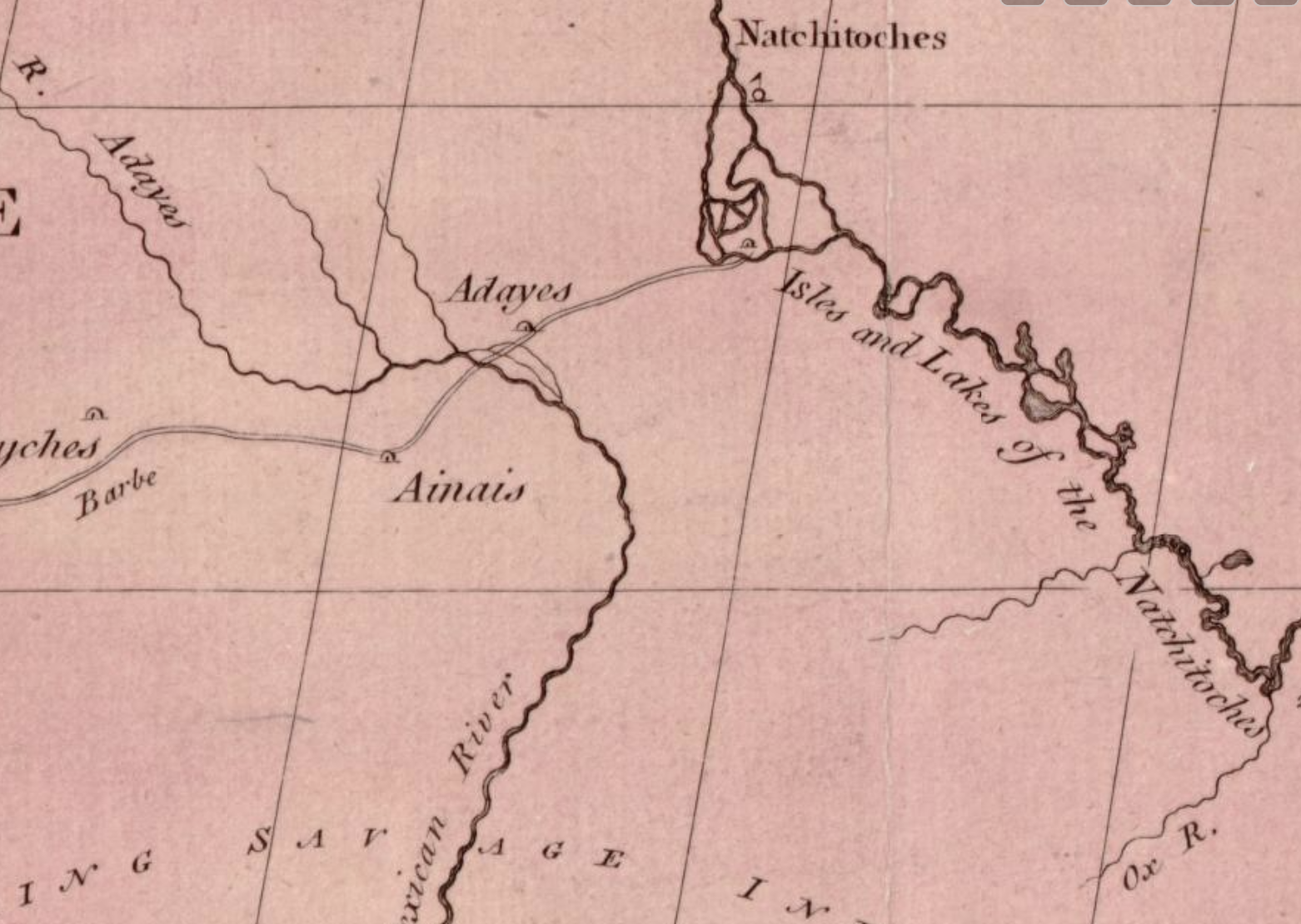
De Vaca writes in the year 1530 that 'we were among the Adais' seeking directions. They were the first white men to travel westward over the buffalo trail.
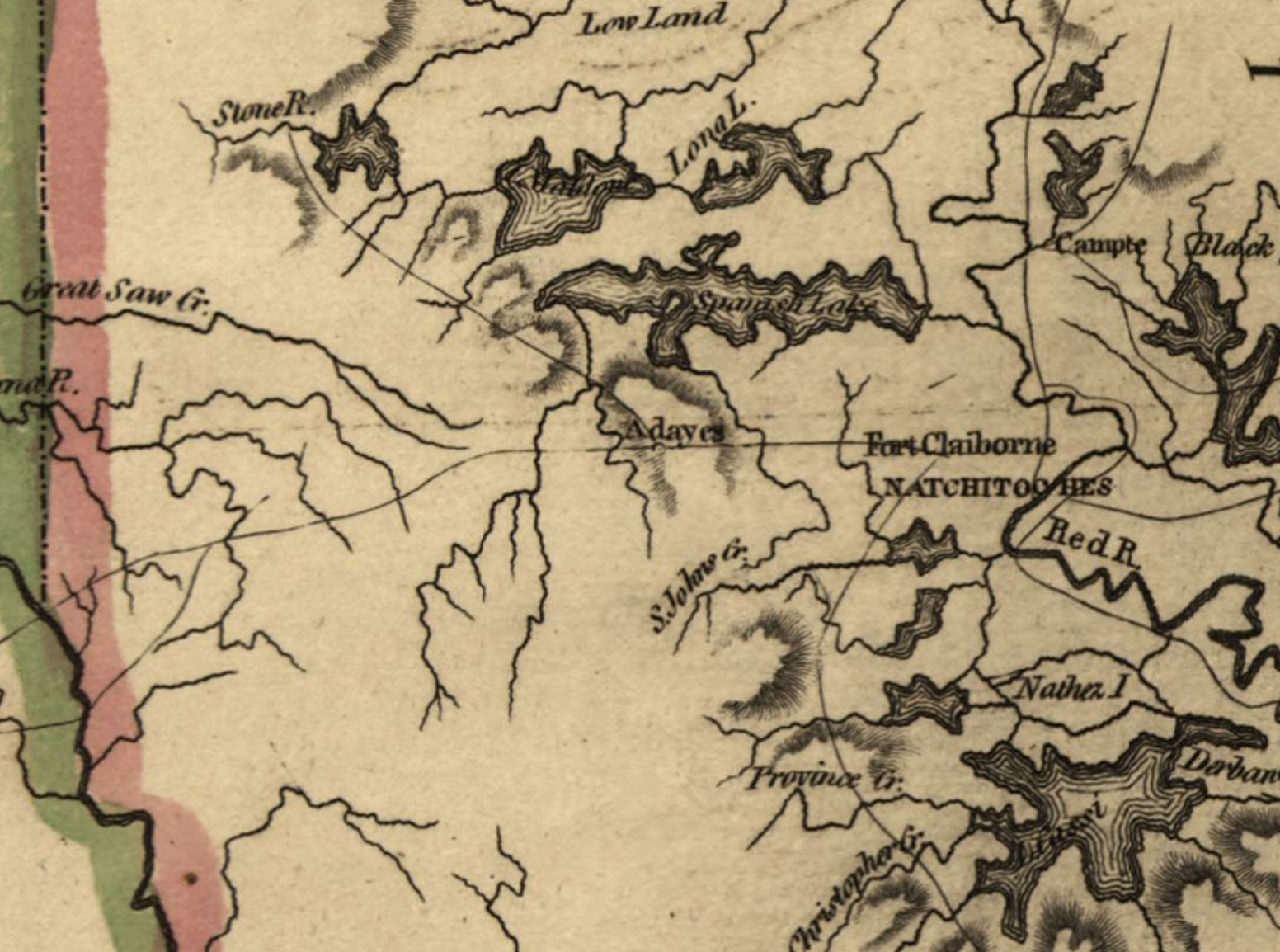


The Adaes roamed over, and dominated all that portion of Louisiana, now traversed by Southern Pacific Company, from Lake Charles to Sabine River.
Longfellow refers to the Mission and the tribe, in line. 'Unto the town of Adayes to trade for mules with the Spaniards.'
Here, from Acadia and the Adaes Mission, came Evangeline, threading her difficult way in fading footsteps of one who was of more worth to her than all else ' twixt Earth and Heaven.